Integrated interpretation of airborne geophysical data
Aerogeofizika offers turnkey airborne geophysical surveys, including full geological and geophysical interpretation of the results. We use both widely accepted processing and modelling methods and original geological and geophysical data interpretation technologies developed by the company’s specialists to address the widest range of predictive exploration tasks.
Examples of geological tasks that can be addressed include:
- refining the deep structure of an area by compiling maps of basement structural and lithological complexes and tectonic maps;
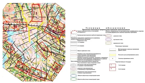
- compilation of a predictive metallogenic map for solid minerals (identifying prospective ore zones, clusters and targets, and providing recommendations on the direction and sequence of exploration work);
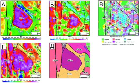
- prediction of primary diamond potential (integrated analysis identifies and ranks magnetic and multiparameter anomalies and produces a catalogue of prospective anomalies, whose coordinates are plotted on a structural-tectonic map);
- study of the morphology of sedimentary-cover structures and identification of geophysical predictive exploration criteria for the distribution of hydrocarbon-bearing geological structures of different orders (resulting in a map of potentially prospective hydrocarbon-bearing geological structures at the appropriate scale).
The company’s specialists perform integrated geological and geophysical interpretation of airborne geophysical data using all available prior information (including geological data and ground geophysical and geochemical survey materials). Where necessary, archival geological and geophysical information is collected, analysed and evaluated. Reprocessing and reinterpretation of earlier geophysical surveys are also possible.
The following interpretation methods may be used to address geological tasks:
- various filtering operations (transformations) applied to the original fields and geophysical models;
- estimation of the depths to the upper and lower edges of anomalous bodies using various methods for locating singular points;
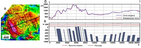
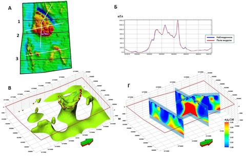
- construction of volumetric models of effective-property distributions using 3D inversion algorithms;
- local quantitative interpretation methods based on 3D modelling, aimed at identifying isolated geological bodies and estimating their parameters;
- 3D modelling of the gravity field to construct a consistent seismic-density model;
- separation of fields generated by sources at different depths within the basement and sedimentary cover using automated modelling;
- methods for zoning an area by a combination of attributes, operating in both automatic and interactive modes;
- fault mapping;
- probabilistic and statistical analysis methods aimed at identifying indirect criteria and indicators of mineralisation localisation;
- prediction of the structural configuration of reference reflecting horizons between survey lines using machine-learning algorithms applied to integrated geophysical data.