Exploration for solid mineral deposits
The distinctive advantages of airborne geophysical surveys—high productivity, integration of methods, low cost and rich information content—make them well suited to reconnaissance ahead of the main exploration programme. Their interpretation results can then be used to guide exploration decisions during the principal stage of geological exploration.
An important advantage of airborne geophysical technologies is the practicality and effectiveness of integrating methods. The methods currently used in exploration for solid mineral deposits include:
- aeromagnetic surveying (in all cases);
- time-domain or frequency-domain airborne electromagnetic surveying (in most cases);
- airborne gamma-ray spectrometry (in most cases);
- airborne gravity surveying (in selected cases);
- LiDAR surveying and aerial photography (where required).
Work stages:
- preliminary preparation and planning, including obtaining the necessary permits;
- survey flights, including system checks, adjustments and calibration procedures;
- preliminary and office-based data processing;
- geological and geophysical interpretation of airborne survey data to identify prospective areas for ground verification.
Following office-based processing of all acquired data, the standard deliverables supplied to the client are:
- a map of the actual flight paths;
- a digital archive of flight-line data, including raw and final levelled data;
- gridded physical-field data and their transforms;
- a set of contour maps of the fields and their transforms;
- a report describing survey and data-processing methods and instrumentation, together with evidence of the quality of the work.
The next step is integrated data interpretation. Initial analysis of airborne geophysical results comprises a general interpretation addressing broad geological objectives, such as structural and tectonic mapping, lithological and petrophysical mapping, and landscape–geological zonation. Exploration-specific objectives are mainly addressed during the subsequent interpretation stage, drawing on all available prior geological and geophysical information.
The methods used in the second interpretation stage can differ substantially depending on the exploration target. Where the target is well localised and has distinct physical boundaries, local interpretation methods aimed at identifying isolated geological bodies and estimating their parameters are the most effective.
For low-contrast targets, such as primary precious-metal deposits, two complementary approaches appear most effective: successive mapping of predictive factors controlling mineralisation, and probabilistic prospectivity modelling using pattern-recognition algorithms. Specialised data analysis and modelling methods play a decisive role in interpreting geophysical data generally and airborne geophysical data in particular.
The resulting deliverables are:
- a map of geological and geophysical interpretation results incorporating prospectivity assessment, showing the most clearly expressed geological features, criteria and indicators of mineralisation, and first- and second-priority prospective areas;
- a report describing the airborne geophysical data interpretation methodology and results, with recommendations on the direction and sequence of further exploration in prospective mineralised areas.
Examples
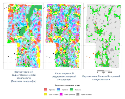
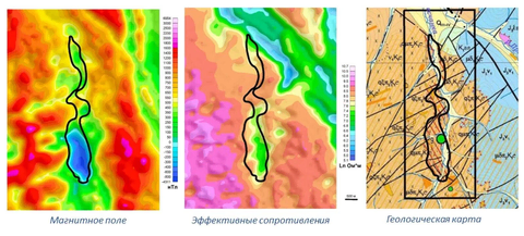
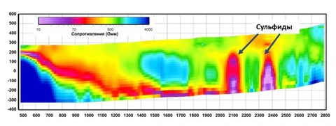
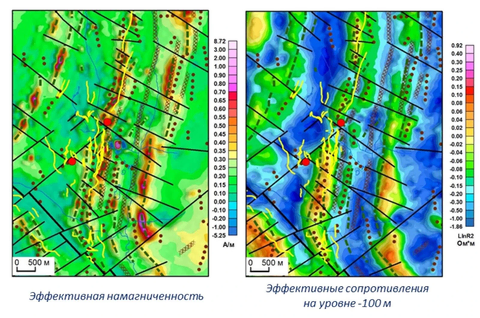
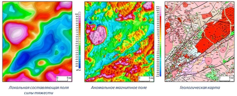
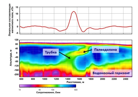
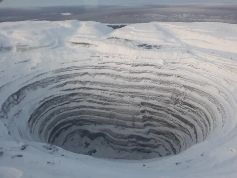
The following examples illustrate the expression of exploration targets, or of indicators of their prospectivity, in geophysical fields and models.