UAV surveys
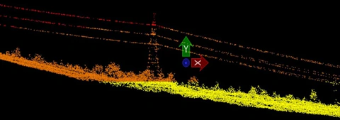
The laser scanner’s instantaneous position and orientation are determined using a high-precision GPS–GLONASS receiver operating in differential mode together with an inertial measurement unit (IMU). Given the scanner’s orientation angles and coordinates, the absolute spatial coordinates of each laser return can be uniquely determined.
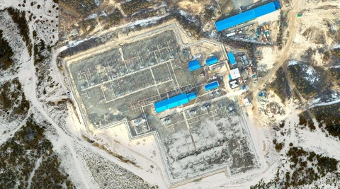
Processing digital aerial photographs produces orthophoto maps: photographic maps tied to an accurate geodetic reference framework. Orthorectification removes image distortions caused by terrain relief and departures of the camera axis from the vertical during acquisition. The aerial images used to produce orthophoto maps are of high quality, with resolutions as fine as a few centimetres per pixel.
Orthophoto maps are particularly valuable for geodetic, topographic, geological, hydrological and environmental investigations, land management, architectural and civil engineering design, and supervision of construction and installation work.
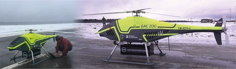
Surveys are conducted using both crewed aircraft and UAVs.
Services offered:
- planning and execution of integrated surveys using airborne laser scanning and digital aerial photography;
- planning and execution of geodetic work to establish horizontal and vertical control for survey flights and install permanent benchmarks;
- office-based processing of raw data to produce topographic plans, GIS layers and virtual models.
Main objectives:
- planning geological exploration traverses;
- landscape zonation and planning of ground geophysical and geochemical surveys;
- seismic survey operations, including “Green Seismic” practices: minimising tree clearance and fuel and lubricant consumption; optimising survey-line placement with regard to terrain and forest cover; and planning logistics and movements within licence areas;
- geological and structural interpretation of linear and circular features of various origins, including tectonic, magmatic, lithological and human-made features;
- calculation of terrain corrections for high-precision gravity surveys;
- creation and updating of high-precision topographic base maps for active licence areas;
- production of engineering topographic plans for deposit-development design, including planning of mining and drilling operations;
- design and construction of access roads and utility networks;
- monitoring of mineral extraction volumes in open-pit operations;
- delineation of inundation zones resulting from rising water levels;
- refinement of site information to support project investment appraisal and business planning.
System features:
- laser scanning produces high-precision models of terrain and objects;
- independence from the presence of forest cover, as the laser pulse “penetrates” vegetation;
- the workflow does not require lengthy stereoscopic processing or photogrammetric adjustment; aerial image overlap requirements are therefore substantially lower than in conventional aerial photography, while terrain-model quality is considerably higher;
- high productivity: up to 200 km2 can be surveyed in one day at a detail level corresponding to 1:2000, and up to 1000 km2 at 1:5000.
Principal deliverables:
- orthophoto maps with 5–30 cm ground resolution in the visible (RGB) and near-infrared (CIR, IR) bands;
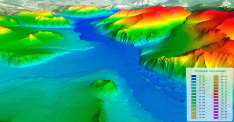
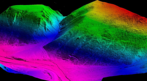
- digital terrain models as grids with 0.5–1.0 m spacing or as TIN models (AutoCAD, ArcGIS);
- maps of slope angle, slope aspect, surface curvature and drainage basins derived from digital terrain models;
- vegetation-height grids, expressed in metres above ground level;
- vegetation traversability maps using three traversability classes;
- thematic vector GIS layers at scales of 1:1000–1:5000;
- digital topographic plans at scales of 1:500, 1:2000 and 1:5000, prepared in accordance with GOST standards;
- original three-dimensional laser-return point clouds with densities of 2–10 points/m²;
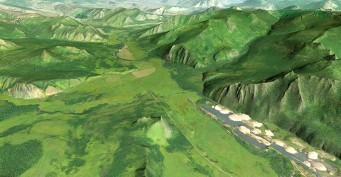
- virtual models of survey areas.
Application sectors:
- mining;
- municipal services and infrastructure;
- engineered and industrial structures;
- mapping for engineering site investigations and cadastral work;
- construction;
- fuel and energy facilities;
- natural resources and agriculture;
- emergency monitoring and prevention;
- ecology and the environment;
- architecture and landscape design. Digital terrain model