Airborne thermal infrared imaging
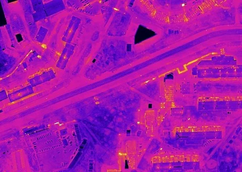
Airborne thermal infrared imaging records electromagnetic radiation from the ground surface and surface objects in the infrared (IR) spectral region and converts it into a visible image. In the mid- and far-infrared regions, objects emit their own IR radiation, the intensity of which is largely determined by their thermal state. Imaging in these spectral regions is therefore termed thermal infrared imaging, which most fully reflects the nature of the method.
Airborne thermal infrared imaging offers undeniable advantages over other monitoring techniques, including a choice of survey modes, low operating costs and rapid execution.
Principal thermal imager specifications
Surveys use the new IKAR-3 high-resolution thermal infrared scanning system:
- thermal infrared signal acquisition in the 8–14 μm spectral range with high geometric resolution: 4500 samples per image scan line at a scan rate of 230 lines per second;
- total field of view: 120°;
- instantaneous field of view: 0.7 mrad;
- scanner design: Kennedy;
- thermal sensitivity in the 8–14 μm spectral range: 0.04 °C at a background temperature of 20 °C;
- continuous operating time: up to 12 hours;
- operating temperature range: −10 to +35 °C;
- lossless data packing and recording to the onboard computer’s storage device;
- recording of satellite navigation data (GPS–GLONASS) and inertial system data, including heading, roll, pitch and flight altitude.
Main objectives:
- locating and assessing the condition of buried district-heating networks, including identification of failure-prone and failed sections;
- monitoring heat losses from buildings and structures;
- mapping and condition assessment of gas and petroleum-product pipelines;
- identification of subsurface spontaneous-combustion zones in waste disposal sites (landfills), peatlands and forests; identification of municipal and industrial wastewater discharges into rivers and other water bodies;
- mapping of petroleum-product contamination;
- identification of waterlogged and groundwater-flooded areas;
- monitoring the condition of road pavements and airport runways.
Survey features
- key advantages of airborne thermal infrared imaging over other monitoring methods are its high productivity, rapid execution and relatively low cost.
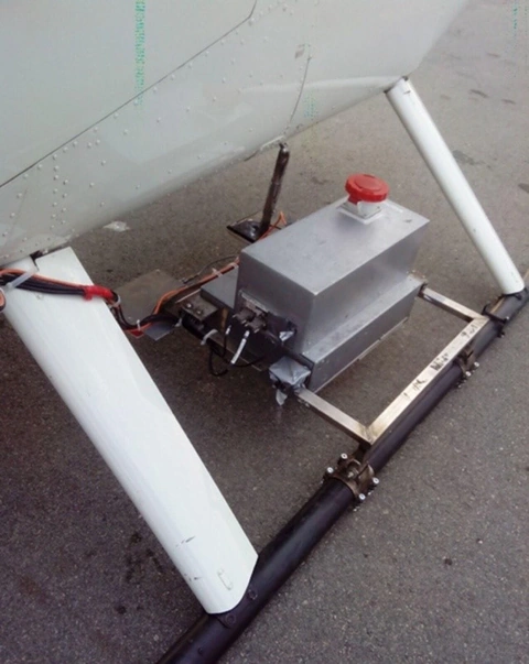
- the compact dimensions (500 × 300 × 300 mm), low mass (20 kg) and low power consumption (200 W) allow the thermal imager to be installed even on ultralight aircraft, either inside the aircraft or externally on a cantilever mounting bracket.
- new onboard software enables real-time image correction for aircraft roll and pitch.