


In December 2021, our company carried out airborne thermal infrared imaging (TIKAS) of Vladivostok to map and remotely diagnose the condition of the city’s heating networks, specifically in its largest districts, Leninsky and Pervomaysky, covering 30 km².
One of JSC GNPP Aerogeofizika’s activities is airborne thermal infrared imaging (TIKAS) of urban areas for remote monitoring of municipal infrastructure condition.
In December 2021, our company carried out airborne thermal infrared imaging (TIKAS) of Vladivostok to map and remotely diagnose the condition of the city’s heating networks, specifically in its largest districts, Leninsky and Pervomaysky, covering 30 km².
To identify sections of heating networks with high heat losses, flights were conducted in a Eurocopter AS-350 helicopter at an altitude of 300 m, carrying the IKAR-002M high-resolution thermal imaging scanning system.
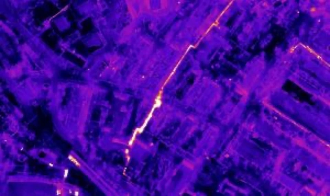
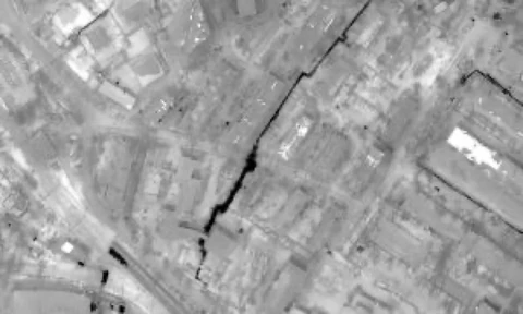
Hidden defects, such as poor insulation and flooding of heating networks, cause high heat losses. TIKAS makes these defects visible and identifies failed and failure-prone sections of underground heating networks that cannot be detected by simply walking the routes and visually inspecting heating mains.
TIKAS identified 117 sections with high heat losses; the data were delivered to the customer, the Primorskaya Generatsiya branch of JSC Far Eastern Generating Company.
Watch the video report