

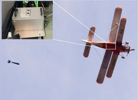
JSC GNPP Aerogeofizika conducted an integrated airborne geophysical survey at a scale of 1:50,000 in the Krasnovishersky District of Perm Krai, Volga Federal District (map sheet Р-40-XXXV, Kvarkush area), as part of a state assignment covering FSBI VSEGEI projects
JSC GNPP Aerogeofizika conducted an integrated airborne geophysical survey at a scale of 1:50,000 in the Krasnovishersky District of Perm Krai, Volga Federal District (map sheet Р-40-XXXV, Kvarkush area), as part of a state assignment covering FSBI VSEGEI projects. For the first time worldwide, a strapdown airborne gravimeter was incorporated into the instrumentation suite used for aeromagnetometry, airborne electrical surveying and airborne gamma-ray spectrometry.
The experimental and methodological work demonstrated the feasibility of using airborne gravimetry with a new generation of airborne gravimeters as part of the combination of methods normally used to investigate areas prospective for mineral deposits.
The final report, presenting interpretation of the acquired data, was successfully reviewed at a meeting of the FSBI VSEGEI Academic Council and contains the principal results:
- refined the structure of geological formations making up the junction between the West Ural Fold-and-thrust Megazone and the Central Ural Uplift;
- mapped both exposed and concealed dykes and small intrusions of Late Riphean, Early Vendian and Early Devonian gabbroic rocks;
- identified local anomalies in airborne gamma-ray spectrometry data associated with leucogranite intrusions of the Vendian–Cambrian Vels complex;
- identified deep-seated fault and block structures using airborne gravity data;
- confirmed the reverse-fault and thrust nature of several faults in sections through the three-dimensional effective density model;
- identified local negative anomalies in airborne gravity data, presumably caused by buried granitoid intrusions that may be associated with occurrences of gold, tungsten, polymetallic ores and rare elements.
